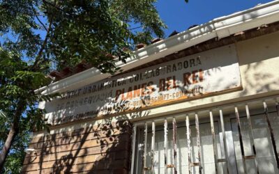
After many years of administrative deadlock, debates, procedures and uncertainty, the reparcelación of the Les Planes del Rei urbanisation has now officially been registered in the Property Registry of Falset.
This registration probably represents one of the most significant administrative and land-planning developments that Planas has experienced in recent decades.
The official document shared in recent days now confirms that the new legal and cadastral organisation of the urbanisation has been formally registered.
For many property owners, this step also marks the beginning of a new phase in the history of Planas.
What is a reparcelación?
A reparcelación is an urban planning operation intended to legally reorganise the land within an urbanisation.
Its objectives include:
- clarifying plot boundaries;
- updating land surfaces;
- officially assigning roads and public areas;
- adapting plots to the current urban planning reality;
- and legally preparing future infrastructures.
In the case of Planas del Rey, this operation comes after decades of inconsistencies between:
- historical notarial deeds;
- the cadastral records;
- the old development plans;
- and the physical reality of the terrain.
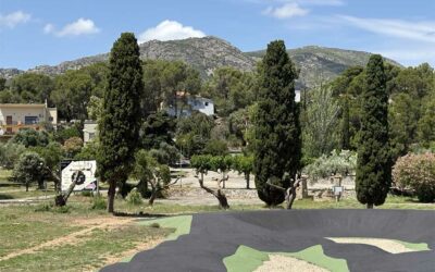
An urbanisation built on complex terrain
The particular geography of Planas also partly explains some of the historical difficulties.
Many houses were built:
- on sloping land;
- in rocky areas;
- with natural boundaries that were sometimes difficult to define;
- and within a complex landscape typical of the region.
Many plots seem to have originally been designed more on theoretical plans than on modern and precise topographical measurements.
The reparcelación is intended precisely to legally stabilise this reality.
Sometimes significant differences in surface areas
The first analysed documents show that some plots present sometimes significant differences between:
- the surface areas historically mentioned in notarial deeds;
- the cadastral data;
- and the topographical measurements retained in the different reparcelación projects.
However, these discrepancies do not appear to be new.
In several files consulted, surface adjustments were already appearing in technical documents more than ten years ago.
This mainly confirms the existence of significant historical administrative disorder within the urbanisation.
What this registration actually changes
The registration in the property registry constitutes an important step, but it still does not resolve all issues.
Many elements still remain to be clarified:
- the exact overall cost of the operation;
- the final distribution of expenses;
- the repayment arrangements;
- future works;
- actual timelines;
- and the concrete consequences for each property owner.
During recent meetings organised in Planas, the town hall notably mentioned:
- a possible instalment payment system through BASE;
- the search for financing solutions;
- and the possible creation of an Administrative Cooperation Association.
Several recent exchanges between property owners and municipal representatives also suggest that financing linked to the registration of the reparcelación may have been mobilised by the town hall, although all financial details have not yet been officially clarified at this stage.
Questions still raised by many property owners
Among the many questions that continue to arise among residents are those related to the future status of the urbanisation’s infrastructures.
Some property owners are particularly questioning:
- the future responsibility for water networks and roads;
- the guarantees for maintaining services during future works;
- responsibilities in the event of technical problems;
- and the real participation of public administrations in the overall financing of the operation.
Several residents also point out that their purchase deeds primarily concerned a plot of land and a house, without any explicit mention of future responsibility for collective infrastructures of such importance.
Others, on the contrary, believe that the urbanisation will no longer be able to function sustainably without a gradual and structured renovation of networks and infrastructures.
These debates will probably continue to fuel discussions in the coming months.
A development that now goes beyond the sole case of Planas
Several recent signals also show that the Generalitat of Catalonia seems willing to play a more active role regarding urbanisations suffering from historical urban planning deficiencies.
In recent months, several press articles and political statements have highlighted the need to progressively move away from the “all or nothing” model, which has blocked many urbanisations for decades.
This evolution could eventually also influence how cases such as Planas del Rey will be approached.
Above all, it reminds us that Planas is probably not an isolated case, but rather the result of complex urban and administrative management affecting many Catalan urbanisations built during the 1960s and 1970s.
A new phase for Planas
Whatever opinions may exist regarding the past management of the urbanisation, this registration seems to mark an important turning point.
For decades, Planas remained in a sort of administrative grey zone:
- an urbanisation that was built but never fully integrated;
- aging infrastructures;
- disputed responsibilities;
- and the absence of any truly implemented global solution.
The current situation shows that a process of land restructuring and urban reorganisation is now officially underway.
But one thing now seems certain:
the reparcelación of Planas del Rey is no longer just a theoretical project.
It is now officially registered.
20/05/2026
Jim – La Tribune de Planas
Documents:
The official document from the Falset Property Registry can be consulted here.
Read also: Unregularized urbanizations: Catalonia wants to move away from the “all or nothing” model
Read also: Unregularized urbanizations: Catalonia faces a historic problem